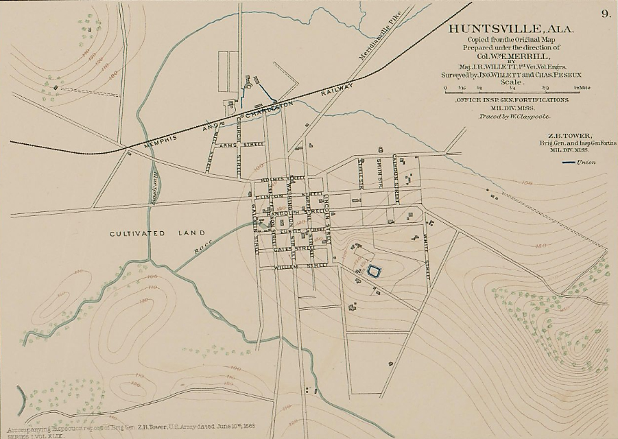
This map is from the Atlas that accompanied The War of the Rebellion, published by the U.S. after the war. The only fortifications in town were atop the hill on McClung and at the depot. Echols Ave was cut through later. The map provided by Patrick Graves.